Name in Chinese: 新疆 Xīn Jiāng [ʃindʒæŋ]
Location: Northwestern China, GMT+8
Population: 25.23 million
Keyword: the Oases in the Gobi Desert, the Silk Road, the Heavenly Mountain, Kanas Lak
Overview
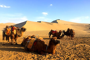
Xinjiang Uighur Autonomous Region lies in the northwest part of China. It is the largest province in China, covering an area of 1.66 million square kilometers(640,930 sq.mi). The province is divided into 14 prefectures. Some of the popular holiday destinations are Urumqi, Turpan, Altai, Kasshgar and Karamay. The vast land is mainly inhabited by the Han, the Uighur people, the Hui, Mongols, the Chinese-Kazakhs, the Chinese-Russians, the Chinese-Tajiks and others. The local traditional cultures are diverse. Xinjiang is well-known as the land of songs and dance, melons and fruits, gemstones and carpets. The ancient silk road run though the Gobi deserts and linked the oases together. One of the lovely oases is the Grape Valley which is located in Turpan. Xinjiang is also remarkable for its scenery. Visitors are usually enchanted by the natural beauty of both Kanas Lake and the Heavenly Mountain.
Attractions
Kanas Lake
Kanas Lake lies at the border region between China, Russia, Kazakhstan and Mongolia. It is a national geo-park and a five-star scenic area. The geo-park covers an area of 10,030 square kilometers(3,873 sq.mi). Well-known as the Wonderland on the Earth, Kanas Scenic Area attracts photographers with its stunning glacial landscape. Set in the U-shaped valleys, Kanas Lake is surrounded by snow-capped mountains, creating a breathtaking scene that seems unreal. Its waters are the most amazing color, a rich shade of turquoise that changes in intensity through summer as the glaciers melt. The lake measures about 45 square kilometers(17 sq.mi) and 188.5 meters(618 feet) in depth. It is the deepest moraine lake in Mainland China. The must-see sightseeing spots in the park are the Crouching-Dragon Bay, the Moon Bay, the Immortal’s Bay and the Fish-watching Pavilion.
The Multi-colored Beach Scenic Area
The Multi-colored Beach Scenic Area lies about 120 kilometers(75 miles) to the south of Kanas Lake National Geo-park. It covers an area 300 hectares(741 acres). As a result of erosion, many gullies have been sculpted on the surface of rock strata by both wind and water. The gullies vary in color and in depth. The landscape of the Multi-colored Beach is amazingly gorgeous.
The Heavenly Mountain and the Heavenly Lake National Park
The Heavenly Mountain and the Heavenly Lake National park lies 97 kilometers(60 miles) to the east of downtown Urumqi. It is a five-star scenic area and a national geo-park. The park was added to the list of world natural heritage sites by UNESCO in 2013. Its wonders are the snow-capped mountains, the mirror-like lake, and the folk custom of Uyghur. The view of the mountain and the lake is very gorgeous.
Koktokay National Geo-park
Koktokay National Geo-park is 57 kilometers(35 miles) from the county seat of Fuyun. It has a huge spread of 788 square kilometers(304 sq.mi). The Irtysh River flows through the park, creating a dramatic canyon. As a five-star scenic area, the landscape of Koktokay features rolling mountains, murmuring streams, picturesque glacial lakes, virgin forests and verdant pastures. Natural attractions in Koktokay Geo-park include the Irtysh Grand Canyon, the Grove of Birch Trees, the Bell-shaped Hill, etc.
Wuerhe Yadang National Geo-park
Wuerhe Yadang National Geo-park is also called the City of Devils. It covers an area of 10 square kilometers(3.81 sq.mi). The word “Yadang” originated from the Uighur language which means steep hills. It refers to a special landform in the Gobi Desert of China of which the formation is a result of wind erosion. The park features the absolutely unique Gobi Desert Landscape and the odd-shaped hills.
Climate
Generally, the weather condition of Xinjiang features the temperate continental climate. The land is completely landlocked and divided into two basins by three mountain ranges. The two basins are Tarim Basin and Junggar Basin. The three mountains include Altai Mountain, Tianshan Mountain and Kunlun Mountain. The weather is always sunny, but unbearable hot and dry in summer. Particularly, the temperature in the Gobi desert may ascend to 40℃(104℉) in the baking July. When the winter comes, the ground will be frozen solid. The best time to travel to Xinjiang is between April and June. You need to bring some suncream and sunhats to prevent your skin harmful effects of the sun and the winds.
Local Specialities
The Mutton Kebab
The Uighur people are devout Muslims. They never consume pork. One of their favorites is the mutton kebab.
How to Get to Xinjiang
Urumqi is the capital city and aviation hub of Xinjiang Autonomous Region. Urumqi Diwopu International Airport is located 17 kilometers(11 miles) to the center of the city. Tourist can fly to Urumqi from most of major cities in Mainland China, such as Beijing, Chengdu, Xi’an, Shanghai and Guangzhou.
Author: Tina Luo
Update: