Name in Chinese: 林芝 Lín Zhī [lindzi:]
Location: Southeastern Tibet, China, GMT+8
Population: 231,000 as a prefecture, about 35,000 living in the city proper
Telephone Code: +86894
Reputations: Switzerland’s Twin Sister in China’s Tibet, the Land of Milk and Honey on the Roof of the World
Nyingchi is a prefecture in Southeastern Tibet. It is regarded as Switzerland’s Twin Sister in China’s Tibet. The prefecture is famed for the stunning view of Basum Lake, the dramatic landscape of Yarlung Zangbo Grand Canyon and the spectacular scenery of peach gardens. Nyingchi is also known as the Land of Milk and Honer on the Roof of the World, due to its relatively low altitude and warm climate. The average elevation of Nyingchi is about 3,000 meters(9,843 feet) above sea level. It is the lowest city in Tibet. Therefore, the risk of suffering from Acute Mountain Sickness in Nyingchi is relatively small when compared with other cities. The prefecture is mainly inhabited by Tibetans. Some other native peoples are the Menba, the Luoba, the Nu and the Dulong. The local Tibetans make up 90% of Nyingchi’s population.
Attractions
Basum Lake
Basum Lake lies about 120 kilometers(75 miles) to the northwest of downtown Nyingchi. It is a five-star scenic area. Pagsum Lake measures about 27 square kilometers(10.4 sq.mi) and 120 meters(394 feet) in depth. It is the largest lake with lowest altitude in Tibet. Its altitude is 3,480 meters(11,417 feet) above sea level. The view of the lake is extremely beautiful.
Yarlung Zangbo Grand Canyon
Yarlung Zangbo Grand Canyonlies 84 kilometers(52 miles) to the east of downtown Nyingchi. The Yarlung Zangbo River makes a horseshoe-shaped turn at the foot of Namcha-barwa Mountain. It is the deepest and longest canyon in the world with a total length of 504.6 kilometers(314 miles) and an average depth of 2,268 meters(7,441 feet). Namcha-barwa Mountain is the highest peak on the east mountain range of Himalaya. Its altitude is 7,782 meters(25,531 feet) above sea level.
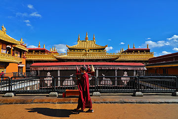
Lamalin Monastery
Lamalin Monastery is also called Bujiu Lama Monastery or Sangduobai Monastery. It is the biggest lamasery in Nyingchi prefecture. Lamalin Monastery belongs to the Nyingma Sect of Lamaism. It was built in the early Twentieth century. The lamasery is situated on a mountain slope in Buqu Township, overlooking the Nyang River, 29 kilometers(18 miles) to the south of downtown Nyingchi.
Climate
Nyingchi Prefecture lies in the southeast part of Qinghai-Tibet High Plateau. Its altitude ranges from 155 meters(509 meters) to 7,782 meters(25,531 feet) above sea level. The big difference of elevation leads to complex and diverse weather conditions, ranging from the cold climate in high mountains to the semi-tropical climate in valleys with a relatively lower elevation. The tropical latitude of Nyingchi means that tourists need to bring some suncream and sunhats when they travel to Nyingchi. The average temperature in Nyingchi varies between minus 2℃(28..4°F) and 11℃(51.8°F) in spring, 8℃(46.4°F) and 20℃(68°F) in summer, 12℃(53.6°F) and 23℃(73.4°F) in autumn, 0℃(32°F) and 14℃(57.2°F) in winter. Both spring and autumn are the best time to travel to Lijiang. The spring comes in February and goes in April, while the autumn lasts from September to November.
How to Get to Nyingchi
Nyingchi Mainling Airport is located 52 kilometers(32 miles) to the south of downtown Nyingchi. It operates flights to some major cities in Mainland China, such as Chengdu, Chongqing, Beijing, Kunming and Guangzhou. The tourists can also travel to Nyingchi from Lhasa by car or train. The construction of the railway between Lhasa and Nyingchi was completed by the end of 2020. It is the west section of Sichuan-Tibet Railway. The railway between Nyingchi and Ya’an, Sichuan is still under construction. In the future, people can ride a train to Nyingchi or Lhasa from Chengdu.
How to Avoid Acute Mountain Sickness
The City of Nyingchi is at an elevation of some 2,900 meters(9,514 feet) above sea level. Some attractions in the prefecture are higher than the city. Its highest point, Namcha-barwa Mountain is 7,782 meters(25,531 feet) above sea level. The tourists might suffer from the Acute Mountain Sickness(AMS). Tips for you to prevent the AMS include keeping hydrated, avoiding a cold, acclimatizing to altitude gradually, avoiding rapid ascent and strenuous exercise, restraining from smoking and drinking alcohol.
Author: Tina Luo
Update: